cycling in Basel, Switzerland: Strava route-find and a Gempen dirt climb
As I write this, I'm on a TGV waiting to leave the Paris Gare de Lyon station for Zurich. I get off in Basel. The total trip is little more than 3 hours. Really remarkable. It's considerably more distance than the train between Santa Barbara and "San Francisco" (really Emeryville), the Coastal Starlight which is a 1-a-day affair in each direction. Delays of several hours are common. The TGV, on the other hand, is of course precisly on time. Indeed the entire timing board in Gare de Lyon was "á l'heure".
Prior to the weekend in Paris, I was in Basel last week. A search on Strava Segment Explorer turned up one obvious "local" source of climbs: the road to Gempen, a nearby hilltop town, small and rural, remarkably isolated from the Basel semi-sprawl.
There's two main paved climbs from Basel to Gempen. The most heavily trafficked, by far, is the 2-lane road from Dornach to the west. Dornach is somewhat inland from the Rhein, and reaching it from central Basel isn't too bad, given the extensive bike infrastructure including bike paths, lanes, and bike-specific signals. But navigating off my iPhone without a corresponding mount for my Ritchey Breakaway meant I had to frequently stop, remove my phone, unlock it, and check my position on the Strava app. It was slow going, but if I'd known the way it would have been better. Certainly it was no worse than riding my bike across San Francisco, which on routes I know well I find quite enjoyable.
A shorter way is a climb which begins further to the north, in Muttenz, gains a bit more vertical on the climb proper, but is on a narrow, bidirectional one-lane road which is certainly scenic but which may demand a bit more caution than is optimal for producing an optimal effort. I didn't know this, however, when I requested from Strava route finder a way from where I'm staying in Basel and Gempen.
A nice feature I had thought route-finder had was, given one or more segments, to find routes which include the requested segments in the order given. This feature could certainly be provided as long as segments could be mapped to the roads database used by the route finder. This is a non-trivial if. Segment definition and segment matching know nothing about roads. They're just a list of longitude and latitude coordinate pairs to which Strava's segment-matching algorithm compares the longitude and latitude points measured for the activity. This is important because bikes aren't constrained, generally, to pre-defined roads. They can ride pretty much anywhere. However, the option of constraining segments to roads would be a very useful feature, as long as the road data are sufficiently reliable. It could improve the integrity of segment definitions for road rides. But this is a major digression.
So I'd done a route expecting Strava to take me on either of these two paved climbs. Since the resulting route clearly wasn't going anywhere close to Dornach, I assumed it was the northern route, not really looking at it so closely.
As I set off early Thursday afternoon from Basel, I had two options. One was the route loaded into my Edge 500. The other was to track the route on the Strava app. Despite past frustrations with the Edge navigation, the most infamous where it wasn't able to navigate me south on Highway 1 without multiple "off course: turn back" warnings, I was going to give that another try. If it works, it's by far the best option, since it sits on my stem and I can navigate without stopping. Unfortunately it never has really worked, but there's always the possibility of a first time.
But not this time: as soon as I turned on the Garmin I got a "battery low" warning. So off the bike it came. When I plugged it into the charger it read "2%". At some point I'd inadvertantly left it on and it had drained down before finally shutting itself off. So it was the Strava app to save the day.
The Strava app, on the other hand, doesn't seem to do any real navigation: it just draws your point history along with the route itself on the same map. However, this is fine in many instances. While it won't tell you to "turn left", "go straight", "approaching a climb", or whatever, the map clearly shows the route to be taken and the route taken so far.
The problem is I don't have an iPhone mount. Tour Magazine did a review of these in the February 2014 issue, which I coincidentally downloaded for another article. LifeProof was the top scorer, followed by a 3-way tie between Armor-X, Biologic, and Wahoo. I should really get one of these 4 to make app navigation more workable. Without it, I found myself frequently stopping, occasionally backtracking to reach turns I'd missed. My only big question about the case is whether I can avoid the phone requesting a security code when the phone shuts off. I want to be able to put the display back on just with a touch, and the iPhone 5S fingerprint matching is confused with sweaty fingers. But I can look more into that. (added later: Armor-X looks good)
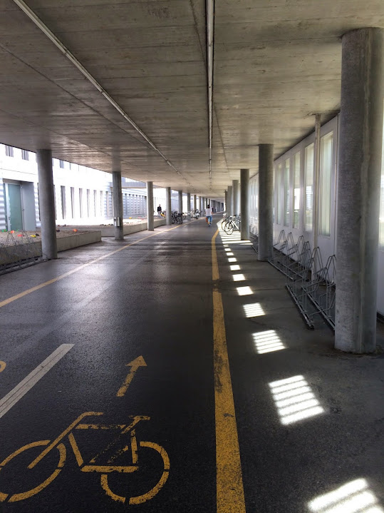
route through Basel
One of these times was a turn I'd seem but rejected. Riding along a paved bike path, I was looking for a left turn which I knew to be forthcoming. I saw a dirt road to the left, and I rejected it. I went further, seeing a roughly paved road which immediately set off at a ferociously steep grade. Was this it? Ahead the path appeared to T-intersect into a busy street.
I stopped, pulled out my phone, entered my code after (as typical when riding) the fingerprint reader rejected me, then brought up the Strava app. Sure enough, it had intended for me to take the dirt road. The paved road extended for only a short distance before giving way to a second dirt road which intersected the first. Indeed the dirt went on for a considerable distance. Strava had routed me this way, a third option in addition to the two paved options I'd expected.
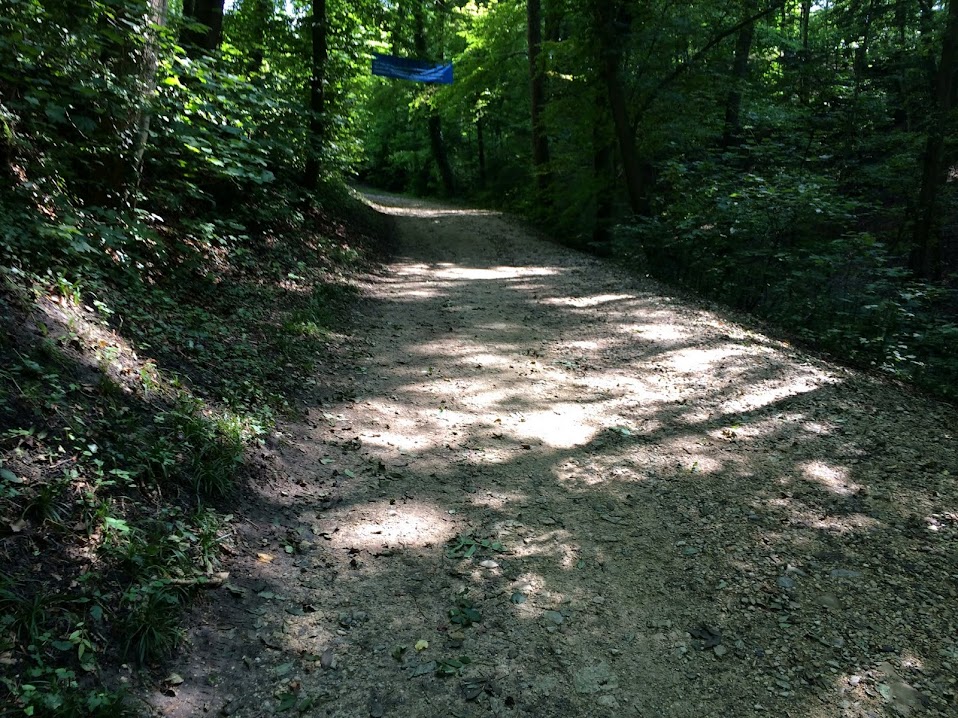
This wasn't my first similar experience with Strava route finder, but in the past it's been with roads and paths I've known, so it was immediately obvious upon first glance what it had done, and I was able to constrain the path to stick to pavement. I don't blame it -- I asked it to connect points A and B with cycling routes, judging the quality of the path based on distance and popularity, and as long as a sufficient number of mountain bikers take the dirt option, Strava considers that a viable candidate.
I like the dirt, so off I went. The riding was a gradual, long climb, with a somewhat rocky but non-rutted surface which was fine on the road bike. The quality of the experience was somewhat attenuated by the need to too-frequently check the phone at junctions.
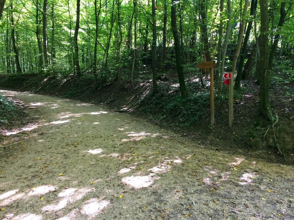
One such junction was where the wide path extended ahead to a series of piles of cut logs. To the right, a narrower, rockier, steeper route climbed onward. I was intended to take this latter option.
I got into my 46/26 and climbed up a steep initial portion before the grade leveled out. But then I heard the unmistakable sound of descending mountain bikers. I pulled to the side of the road as first one then a second downhiller flew by. This didn't bother me: I wasn't in a rush.
But I couldn't get enough traction to restart. My rear wheel would slip on the rocks. I was glad I'd brought mountain pedals and shoes on this trip: my maiden voyage with BeBop pedals, which I really like. They're staying on the Breakaway -- with a low stack (requiring some Dremel surgury on the shoe pads to allow axle clearance part of the standard installation procedure), impressively low mass, and a float similar to Speedplays, the pedals are a great solution where some walking will be required or dirt clearance may be an issue. I'll stick to Speedplay for the racing bike.
So I walked a bit, which offended my "death before dismount" sensibilities, but was functional. And then I was to the paved road.
The Strava route had me turn right on the paved road, take that a bit, then take another dirt path which was to act as a short-cut for a less direct, but no doubt less steep, path climbed by the pavement. I decided to stick to the pavement.
The climbing was surprisingly steep, despite the relatively meandering route. But after more of this than I expected, I was in Gempen.
With all of the stopping to check directions, all of the tentative riding on dirt roads whose character I didn't know, and finally with one to two hundred meters of outright walking, I knew I wasn't going to set any ranking times on Strava this day. Yet as I finally rolled into Gempen, the small agricultural town, I decided I was done climbing for the ride. I descended the wide, open road to Dornach, a steady stream of riders coming the opposite direction, along with two large vehicles with weed-trimmers working the road fringe. This, I decided, I would climb the next day, with a real effort to get a decent Strava ranking.
I semi-improvised my route home, deciding instead of the relatively heavily trafficked route I'd taken out to ride toward the Rhein, then head back along that. This was partially successful, but also involved some decidedly less nice riding. I made it back fine, however.


Comments